2.1 TOPOGRAPHICAL AND CONTOUR TECHNICAL MODELS
_____________________
[table id=64 /]
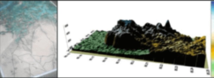
We have developed a new concept in Map Models using Google Earth.
When coordinates are selected for a specified area says 100 kms X 100 kms, we freeze the image. (provided by customers).
The image is further divided into 50 or 60 images depending on the details required. After getting the details the images are then again compressed into the sizes of models required. i.e. 6'X 4’ or as required, in the form of vinyl prints. This print is further built up with clay to depict minute details & accuracy. The job is then molded on fiberglass resin and then painted to details.
So at a glance, an area of 100 km X 100 km can be seen as a model of 6' X 4' - a revolutionary concept in training.
You can see all features like rivers, lakes, hills, mountains, prominent buildings / structure, towns, villages etc. (Pin pointed by flag-posts).
A defensive of offensive operation can be easily studied through the map/model & coordinates shown. The scale comes to approx 1 inch = 5 kms
GLACIERS MODELS
TOPOGRAPHICAL Models with character & object detailing with acrylic cover of size 2 ft x 2ft, material FRP
[table id=65 /]
[table id=66 /]
[table id=67 /]
[table id=68 /]
2.2 SAND MODELS
_____________________
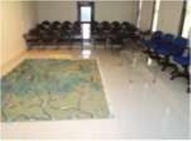
Sand Model Room – CRPF Institute of IED Management, Talegaon (Pune)
a. Customized to User Requirements
b. Ancillary requirements can also be provided: Interactive White Board, Screens, Projectors, Audience Polling system,
[table id=69 /]
[table id=108 /]
1.3 RIFLE AND WEAPON MODELS,FIRED CASE COLLECTOR,DRILL CARTRIDGES
_____________________
[table id=70 /]
[table id=71 /]
[table id=72 /]
[table id=73 /]
Fired Cases Collector Manufactured
[table id=74 /]
1.4 ARMOURED VEHICLES MODELS
__________
[table id=75 /]